Marsh Cirque1ncs
Koordinatar:
| Marsh Cirque | |
| dalbotn | |
| Land |  Antarktis Antarktis
|
|---|---|
| Stad | Victoria Land |
| - koordinatar | |
| Administrert under | Antarktistraktaten |
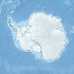  Marsh Cirque (Antarktis)
| |
Marsh Cirque er ein dalbotn sør i Mount Hercules i Olympus Range. Dalbotnen er 2 km brei og er dekt av ein isbre. Han vart namngjeven av Advisory Committee on Antarctic Names (US-ACAN) (2004) etter Bruce D. Marsh, ein geolog, i avdelinga for geovitskap og planetologi ved Johns Hopkins University i Baltimore. Han var forskar for United States Antarctic Program (USAP) ved Basement Sill i McMurdo Dry Valleys i sju feltsesongar, 1995-2005.
Kjelder[endre | endre wikiteksten]
 Denne artikkelen inneheld stoff som er offentleg eige frå United States Geological Survey-artikkelen «Marsh Cirque» (innhald frå Geographic Names Information System).
|
